WhereWasTaken
- No match
Machine translation — the English original is authoritative.
The Story
WhereWasTaken is an AI-powered image geolocation engine designed to identify where a photo was taken by analyzing its visual content rather than relying on GPS coordinates or embedded EXIF metadata. Whether you're working with a travel photo, a social media image, a screenshot from GeoGuessr, or a picture with all location information removed, WhereWasTaken uses advanced computer vision and geographic reasoning to estimate the most likely location based entirely on what appears in the image.
AI Overview
AI-generatedDigital detectives, travel enthusiasts, and competitive GeoGuessr players now have a dedicated tool for solving one of modern photography's central mysteries: determining exactly where an image was captured when traditional metadata trails have gone cold.
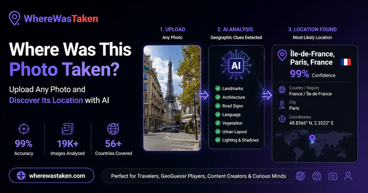
WhereWasTaken addresses a genuine gap in image analysis by treating photo geolocation as a visual puzzle rather than a data-retrieval problem. Where reverse image search relies on finding identical or similar images online, this tool takes a fundamentally different approach by training its AI on geographic patterns themselves. It examines landmarks, architectural styles, road signage, vegetation types, terrain characteristics, and environmental conditions visible in a photograph to triangulate the most probable location.
The product targets three distinct user groups clearly. Travelers use it to verify or understand the context of photos they've captured. Content creators benefit from identifying locations in images before sharing them. GeoGuessr players, who compete by pinpointing locations from Street View screenshots and similar imagery, find it particularly useful since those images often lack usable metadata.
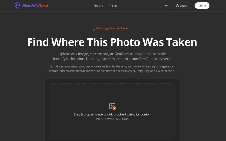
Several features distinguish the offering. The interface emphasizes speed and accessibility through drag-and-drop upload, handling JPG, PNG, and WEBP formats up to 10MB. The system doesn't simply output a location; it provides confidence scoring and identifies the specific visual clues that informed its prediction, giving users insight into how the AI reasoning worked. The examples displayed show real analyses with confidence percentages and demonstrate the types of landmarks the system recognizes, from iconic structures like the Eiffel Tower to regional markers like road designations in Argentina.
The platform claims coverage across 56 countries and cites statistics around accuracy and volume of images processed, though these figures derive from the company's own marketing materials. The offering also expands into related functionality for viewing EXIF metadata and geotagging photos, suggesting a broader strategy around photo location intelligence.
The product fills a genuine need for anyone working with decontextualized images, particularly as privacy concerns push more people toward removing location data before sharing. Whether the AI's predictions hold up in rigorous independent testing remains an important question before relying on it for professional or mission-critical use cases.
Founder Diary
DevlogThe maker hasn't posted a diary entry yet.
Key Features
Drag-and-Drop Upload
Accepts JPG, PNG, and WEBP formats with files up to 10MB in size.
Confidence Scoring
Provides confidence percentages for each location prediction.
Visual Clue Identification
Shows the specific landmarks and environmental patterns that informed the prediction.
Geographic Pattern Analysis
Examines architectural styles, road signage, vegetation, terrain, and environmental conditions.
EXIF Metadata Tools
Includes functionality for viewing and geotagging photos.
Multi-Country Coverage
Operates across 56 countries.
Use Cases
-
1
Travelers
Verify and understand the context of photos they have captured.
-
2
Content Creators
Identify locations in images before sharing them publicly.
-
3
GeoGuessr Players
Pinpoint locations from Street View screenshots and similar imagery that lack metadata.
-
4
Privacy-Conscious Users
Analyze decontextualized images where location data has been removed.
FAQ
What image formats and file sizes does WhereWasTaken support? ▾
How does WhereWasTaken determine where a photo was taken? ▾
Does it explain how it determined the location? ▾
How many countries does WhereWasTaken cover? ▾
Discussion
No comments yet — be the first!
Join the conversation — sign up to comment.
Sign up freeCommunity Support
Boost this project on Sell With boost